|
|
|
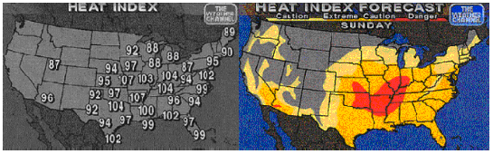
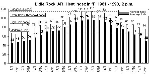
Intrigued, you contact The Weather Channel and request Heat Index maps for the US for late July, 1997. They provide the following maps: Although you realize that Little Rock does not always have the highest Heat Index in the US, it becomes clear that in July it can be dangerously hot. You decide to consult the Zunis Foundation database. After contacting the Zunis Web Site, you receive a chart set. The first chart that you review is the one which you feel will describe the worst-case scenario, the year-long 2 p.m. chart:
Examination of this chart confirms your concern: Events held at 2 p.m. between May 15 and September 15 will, on average, be carried out in the High Risk Zone for heat-related illness. Extremely high temperatures are sometimes encountered. Continued on the Next Page...
|
|
[Home]
[The Chart Room]
[The Map Room]
[The Chart Store]
[The Library] |